This week's cloud is a happy, low-level cloud called
cumulus fractus--relatively small, ragged-edged clouds that seem more like mist than a cloud. The "fractus" part of its name is from the Latin for "part" or "fraction." These clouds typically form as detached cloud at 2,000-3,000 feet above the ground and are scattered across the sky in a somewhat haphazard fashion.
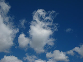
Cumulus fractus form in two ways: They can form in fair weather as rising pockets of warm air rise and condense into these proto-clouds that may develop into larger cumulus clouds with more defined "cauliflower" like edges. As cumulus fractus make their way across the sky, the moist air in them tends to evaporate in the surrounding dry air--so they don't stick around long. Below, you can see the deterioration of one cloud over just a few minutes.
 |
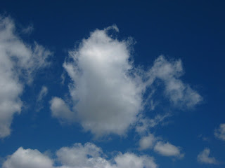
| This is a cumulus fractus cloud at its most compact stage. |
 |
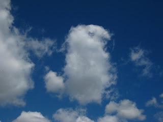
| Same cloud, seconds later, beginning to break up on the "top" side. |
 |
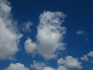
| A few more seconds later it is really losing its form as it evaporates in the surrounding air. |
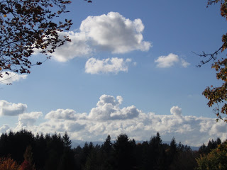 |
| Cumulus fractus may "grow" into larger, more defined cumulus humilis clouds like these. |
You'll see cumulus fractus on not-so-fair days, too, as they "shedded" by larger cumulonimbus cloud after a rain storm (see dark cloud below).
One of the essential qualities of clouds is that they are always in transition, always on their way to becoming something else, never holding the moment too tightly. Cumulus fractus clouds are a great way to start watching clouds because their you can witness their constantly changing forms as they hurry across they sky. More distant clouds, such as the cirrus "Clouds of the Week," actually move faster, but because of they are miles above us, their changes appear to be taking place more slowly and more subtly.