Full Frontal Drama in the Skies Thursday
Here's the text to explain what happend in Olympia last night (Thursday) according the National Weather Service station at the Olympia Airport in Tumwater.
"SYNOPSIS...A STRONG FRONTAL SYSTEM WILL MOVE THROUGH WESTERN
WASHINGTON THIS EVENING. RAIN ASSOCIATED WITH THE FRONT WILL SPREADINLAND THIS MORNING. RAIN WILL BE HEAVY AT TIMES IN THE MOUNTAINS
WITH WINDY CONDITIONS ALONG THE COAST AND OVER THE NORTHWEST
INTERIOR. THE SNOW LEVELS WILL FALL TO PASS LEVEL BY FRIDAY AND
REMAIN LOW THROUGH THE WEEKEND. UNSETTLED WEATHER WILL CONTINUE
UNTIL SUNDAY AS WEATHER SYSTEMS SPIN OUT OF THE UPPER LEVEL TROUGH
OFFSHORE. THE TROUGH WILL MOVE THROUGH WESTERN WASHINGTON ON SUNDAY.
ANOTHER WET FRONTAL SYSTEM WILL ARRIVE MONDAY. THE UNSETTLED WEATHER
WILL CONTINUE THROUGH THE MIDDLE OF NEXT WEEK."
Here's the link to these frequently updated forecast discussions. This is for 98501, but you can type in your zip code and get similiarly detailed forecasts...and even some cloud information! Olympia Weather
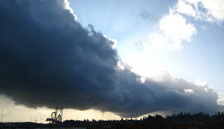
Friday 2 p.m.
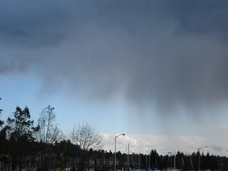
I assumed this curtain was rain falling from the eastern edge of the cloud above.
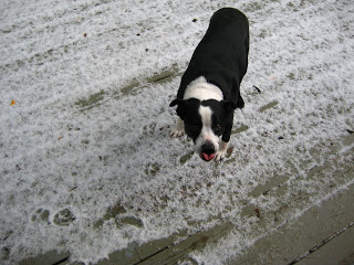
In fact it was hail--a lot of it--falling on my neighborhood four miles away. My dog lapped up what fell on our deck.