|
| A good day to contemplate the clouds. |
I woke up at 4 last Saturday morning and listened for a long while to the rain falling. It wasn’t a soft, gentle rain that might lull a person back to sleep. It was a hard, forceful rain that splattered on the hard, waxy leaves of the evergreen salal, rhododendron, and sword ferns out my bedroom window. It had been raining all night, on and off, mostly on. In fact, it had been raining on and off the previous day and the three days before that. This is to be expected in late February in the Pacific Northwest, especially after a spate of warm sunny days that false sense of spring that makes our hearts leap and crocus rise.
I didn’t need another few hours of sleep on this particular Saturday morning, so I just listened to the rain and tried to imagine what was happening above the rain in the sky. What did the clouds look like that were bringing the rain? How low were they? Where were they coming from or going to?
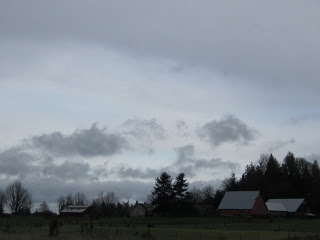
I pictured low, gray clouds—the nimbostratus clouds—moving in from the Pacific Ocean, over the Black Hills to my west, and down into our low-lying town of moss-covered roofs, gushing drainpipes, and soggy yards where miniature streams have meandered in from the street and braided their way across the lawn and flattened clumps of long winter grass.
The rain had a pulsing rhythm so I imagined the clouds in bands—lower dark bands alternating with higher lighter bands. I had no idea how high, low, or wide the bands were, though I knew nimbostratus clouds could reach down to 2,000 feet and stretch across thousands of square miles of sky. From a satellite image, you might call them “extensive,” but on the ground, the word that most often comes to mind is “oppressive.” Especially in February, the month my mother and I called “Feb” because it sounded sodden and heavier, gloomier, and more oppressive than the lilting springing February.
But I’m okay with Feb and its nimbostratus skies. It’s a good time to hunker down and wonder about such basic questions such as “how does rain rain?”
 |
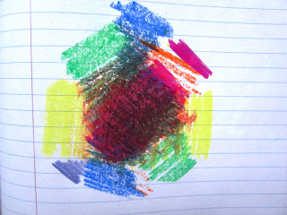
A completely inaccurate depiction of a rain cloud as a sponge.
(Original artwork by the Accidental Naturalist/Accidental Mixed-Media Artist). |
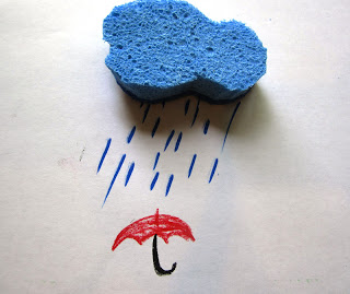
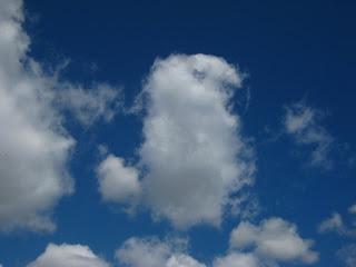
Without thinking through the entire evaporation-condensation-precipitation cycle, it is easy to imagine a cloud like a sponge full of water squeezing out or shedding its contents and then moving on. This is understandable given the way clouds and rainfall are depicted on TV-news weather reports and in the newspaper—a sponge-shaped cloud with dash marks of rain falling from its base. But that puffy, scallop-edged cloud is not a rain cloud; it resembles most closely a type of cumulus cloud—a cumulus humilis. These clouds do not produce rain.
 |
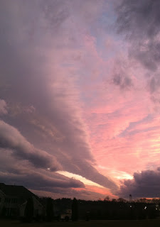
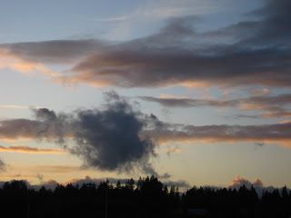
| This is the underside of a cumulonimbus cloud. I know because I got caught in it. |
The two types of clouds that produce rain are cumulonimbus (the towering, convective clouds) and nimbostratus (the low, layered clouds). “Nimbus” means rain and these are the only two of the ten cloud types with this word in their name. Sometimes altostratus clouds produce rain—but it is a light rain, not sustained, and not what anyone where I live would call rain.
"The Rain It Raineth,” wrote Veryln Klinkenborg in his New York Times column, “The Rural Life,” last November. “It’s raining, I think, and then wonder what the “it” is that is doing the raining. Ordinarily, that’s just a linguistic question. But on a cold November day, it feels like a philosophical problem. It makes no sense to say the clouds are raining when the sky is so solidly, grayly felted.” In this delightful seasonal musing from his farm in rural New York, Klinkenborg concludes that “what is raining is the rain, a phrase that sounds like the opening of a grim, Anglo-Saxon lyric.”
He's right on both counts, but I would like to tell you how the rain rains and how a nimbostratus cloud allows this to happen.
Nimbostratus clouds are deep clouds. From their bases at around 2,000 feet above the ground, they may extend as high as 18,000 feet. Nimbostratus are the "wet blanket" of the cloud world--a three-mile-thick wet blanket. So deep or thick are these clouds that they can hide well-developed cumulus clouds within them.
Like all clouds, nimbostratus clouds are composed of an unfathomable number of liquid water droplets, ice crystals, or both. For this blog posting, I am addressing nimbostratus clouds formed by liquid water droplets.
Recall that by the time we can see a cloud, the invisible water vapor in the air has condensed and grown into cloud droplets. The average cloud droplets measure about 20 microns in diameter, less than half the diameter of a dust speck, which, at 50 microns, is the size of the smallest object visible to the naked human eye.
 |
| This, dear readers, is a nimbostratus cloud as seen by the Accidental Naturalist equipped with a few blue markers. My intent was to represent this cloud as a mass of drops and droplets in a complete and total frenzy within the cloud. (Please enlarge the image for better viewing.) |
Within our enormous nimbostratus cloud we have average-size cloud droplets, large cloud droplets (100 microns), and very large cloud droplets (200 microns), and many sizes in between. Within the cloud these droplets will move up and down, responding to both gravity (a constant force), to the natural updrafts within the cloud (a constant, but uneven force), and air resistance (which depends on the size and speed of the drop). During their life in the cloud, some droplets may evaporate and some may condense further and grow into raindrops. The raindrops are much larger than a cloud droplets, measuring from 1000 to 5000 microns. I have difficulty imagining 1000 or 5000 of anything, especially of something I have a hard time imagining--like a micron. So, in Accidental Naturalese, it takes a million cloud droplets to create a raindrop. Give or take.
Now imagine zillions upon zillions of these cloud droplets and raindrops trapped within our nimbostratus cloud. They are all moving up and down within the cloud at different rates, letting gravity and updrafts have their way with them. Though many of the raindrops continue to grow through condensation, they are unable to grow large enough to overcome the updraft to escape the cloud as an earthbound raindrop. All these potential raindrops make for a very threatening cloud. So why doesn't it rain?
Scientists have learned that no matter how much condensation a cloud droplet undergoes, the condensation process alone does not give us our rain. Condensation is a very slow process and meteorologist Donald C. Ahrens notes in his text, Meteorology Today, that it would take several days of condensation to create a raindrop from a cloud droplet. So what is going on here?
Collision and coalescence. Wait wait...don't leave me! This gets fun. Plus, you've already done all the hard work of imagining a huge layer of cloud made up of zillions upon zillions (times ten to the zillionth) of unimaginably teeny and hyperactive drops and droplets of water.
 |
| A detail of the base of a nimbostratus cloud as envisioned by the Accidental Naturalist. Large cloud droplets at the base of the cloud are undergoing the collision-coalescence process. (Please enlarge image for better viewing). |
All those droplets and drops are not moving in unobstructed pathways within the cloud. The are colliding into one another. Think bumper cars at an amusement park and you have the idea. According to Ahrens, as the larger droplets fall faster than the smaller ones, they collide. Some of the smaller ones get caught on the forward end of the droplet, others are captured in the wake of the larger droplet and attach to the larger droplet's backside. The process of droplets getting caught or attaching to each other is
coalescing.
 |
| The dark base of this cloud indicates that it is composed of very large raindrops. Larger droplets absorb more light than they scatter so I'd say it's time to grab your umbrella. |
By colliding and coalescing, many raindrops are now large enough to get out of the cloud and find their way to your umbrella, your roof, your uncovered head. A very large droplet might take an hour to travel through a cloud. Not all collisions end in permanent coalescence. Some collisions are so forceful that the raindrop smashes apart. Reduced in size, the drops and droplets may be again too small to overcome the cloud's updraft.While smaller raindrops are round, larger ones appear flattened (below left) due to increased air pressure against the bottom of the droplet. No raindrop is tear-shaped. Ever.
 |
| Large raindrops (2-3 mm) are the shape of hamburger buns, not the shape of a tear drop . |
What I have just explained about the life cycle of single drop or droplet of water in a nimbostratus probably took you less than five minutes to read. While you were reading there was a nimbostratus cloud floating somewhere over the earth. A cloud miles thick and thousands of square miles wide. A cloud composed entirely of drops and droplets in constant, frenzied, surging motion, up and down and up and down and finally down and out.
With so many impossibly immense and infinitesimally small things to wrap our minds around at once, it is a wonder we can sleep at all.