This is Disappearing Lake in the Gifford Pinchot National Forest the Mount Adams Ranger District in Klickitat County. It’s part of the gorgeous South Prairie and functions as a wetland and prairie in the summer, a basin for holding rain, snow, and ice in the fall and winter, and a lake for a very short period in the spring.
You’ve probably heard of Mt. Hood (second largest volcano in Lower 48), the town of Hood River, Oregon (famous as a wind-surfing, soft-fruit, and craft-beer mecca) and it’s sister town, White Salmon, Washington (white-water rafting, mellow non-Hood-River vibe). You may also be familiar with Gifford Pinchot National Forest—the 1.3 million acres of forested land stretching north from the Columbia River gorge.
As a day hiker who defaults to the Olympic Peninsula and Mt. Rainier for recreating, I have only occasionally visited this beautiful part of Washington State. A few times to hike in the Gifford Pinchot National Forest and once to survey for the egg masses of the endangered Oregon Spotted Frog. Never once did I hear or read about Disappearing Lake or the lake from which the town of Trout Lake gets its name.
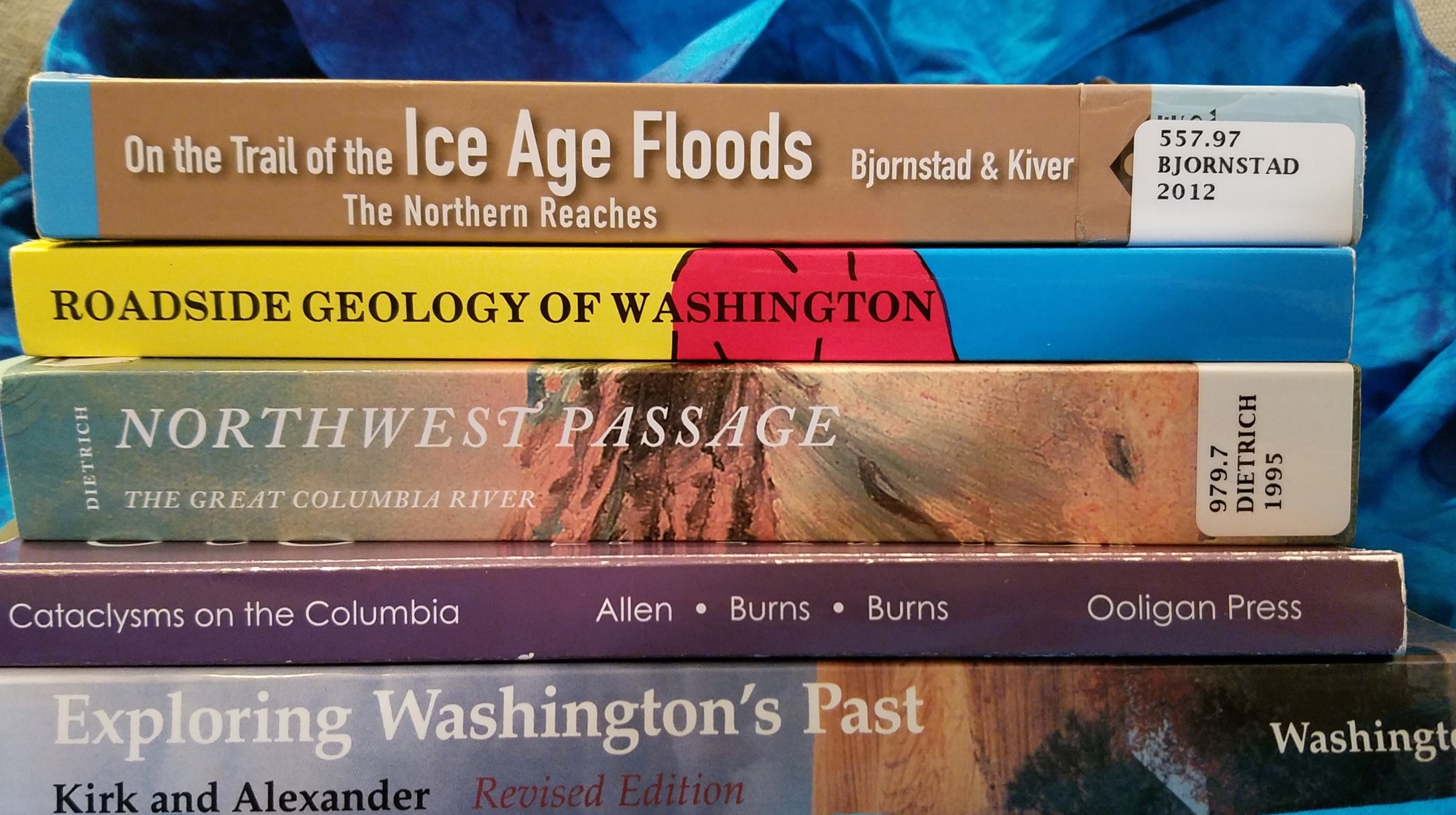
Not until I began my research on Washington Lakes and lake swimming and watched a 2014 episode of Oregon Field Guide (it’s just 6 minutes long, worth a viewing) did I learn about Disappearing Lake. It doesn’t show up on most maps or Forest-Service road signs. It’s just called South Prairie. Which makes sense. It’s part of an extensive prairie south of Mt. Adams and is a prairie from mid-summer to late-fall and then, when the rains come the prairie begins to fill with water. The water that fills a lava tube freezes and acts like a plug in a bathtub. The prairie fills up with rainwater and snow and, in late spring, emerges as a beautiful lake you can canoe and kayak on if you time it right. Like most of my wilderness adventures (see my blog on Banks Lake), I’m always a bit off on my timing of natural spectacles. We arrived in mid-June having just missed the canoe-able—and I had hoped chilly-but-swimmable—period of Disappearing Lake. Alas, I’d pack my wetsuit again next spring and be ready to head to the lake on a moment’s notice to try again.
Not wanting to feel foolish about driving for 4 hours with a canoe strapped to the top of our car and not getting it wet, we headed for Goose Lake. But it was raining heavily that Friday afternoon and there was a fishing derby on the lake the next day. So my husband and I up Sleeping Beauty instead for bit of aerobic exercise and a spectacular view of Mt. Adams dancing with the cumulus clouds. What could top this as a consolation prize?
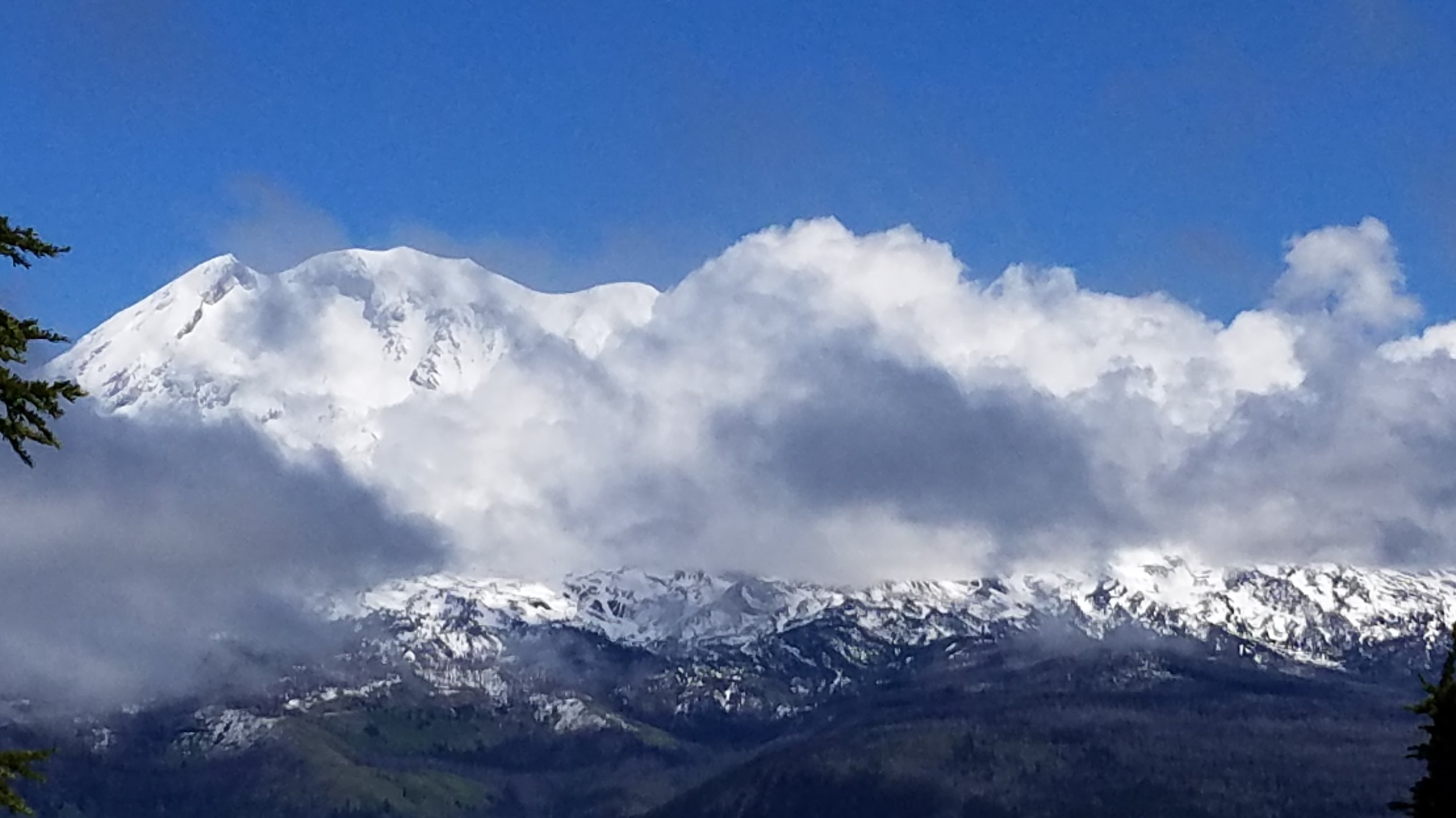
Mt. Adams and the clouds from atop a rock formation known as “Sleeping Beauty.”
On the way back from the hike, we drove through the town of Trout Lake, wondering exactly the eponymous lake was and why there were no signs (not even the subtle Forest Service brown ones) advertising its presence. My husband had a hunch we might have luck following Lake Rd. a road marked as a Dead End. A few minutes later, we parked our car at a classic wooden kiosk and were happy to discover we needed a Discovery Pass. We had arrived at the Trout Lake Natural Area Preserve (NAP) managed by the Washington Department of Natural Resources (DNR). The lake was part lake, part creek, part wetland and a hot spot for the endangered Oregon Spotted Frog.

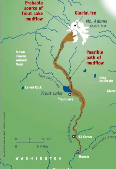
On our left was an interpretive trail that hugged the southwest side of the creek and wetland. Here we learned that an avalanche of volcanic debris and mud, known as a lahar, flowed down from Mt. Adams about 6,000 years ago. The lahar traveled some 35 miles, following the river channels and leaving deposits as thick as 65 feet. The lahar raised the floor of the White Salmon River, thus blocking one of its tributaries—today’s Trout Lake Creek. The newly formed lake was much more extensive than it is today; sedimentation, especially over the last 50 years, has been filling in the open lake, increased the wetlands.

After our short trail walk, we returned to our car and noticed a pair of flip-flops on the muddy edge of the water. That was the only sign I needed that it was time to grab my wetsuit and goggles and launch the canoe.

We weren’t sure if we’d be paddling in a creek or a lake or deadend in a meadow of reed canary grass or for how long before we got stuck, but the water called. To our delight and amazement, we paddled for a good 30 minutes up the most gentle, intimate little waterway a Discover Pass could buy. The shore was undeveloped the bank was tangled with all the makings of a Hollywood riparian buffer: reeds, sedges, rushes, grasses, willows, snags, and cottonwood trees further off. Paddling upstream was easy and the water so inviting.

We pulled off in an eddy at a very grassy spot and, with Oregon Spotted Frog tadpoles wiggling around my toes, I braced myself for a plunge into the clear cold water flowing off Mt. Adams in the distance.

Despite my attempt at looking relaxed (what’s with my right foot?), it was nearly impossible to go gently into that good lake. Or any lake-river that takes your breath away and leaves you uttering ridiculous but ultimately helpful self-motivating phrases.
Getting upstream was harder than I thought. But worth the effort. My first-ever downstream swim was like flying.