 |
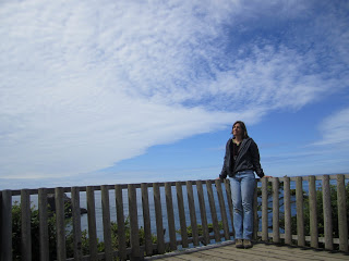
| The Accidental Naturalist at the July 10th SRO "kick-off" of the Tour. |
The Accidental Naturalist's
Live Cloud Tour 2011 has begun! This is not an organized tour; there are no sign ups, no buses, no souvenir cloud tote bags for participants, no cloud identification handbook or checklist included with a box lunch.
It
is organized (last minute) and
does have participants (my husband and cloud-oblivious dog) and I do bring along Cloud Tour Kit: polarized sunglasses, camera, binoculars, maps, compass, windbreaker. The Tour is essentially a series of road trips across Washington State to observe how the clouds and the terrain influence each other.
This is an unorthodox way to travel, but we all have something we want to see when we hit the road--national parks, wilderness trails, fly-fishing rivers, blooming wildflowers, rare birds, wineries, lakeside campgrounds, casinos, local brew pubs, outlet malls. My something is clouds.
Yes, I could just lie in the hammock and let the clouds come to me, but I got my hands on a
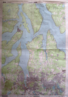
physiographic map of Washington State this winter and it had the same effect that the Burpee's Seed Catalogue does when it arrives in the mail: I wanted everything. I wanted to explore every inch of our state's nine provinces: Puget Lowland, Portland Basin, Willapa Hills, Olympic Mountains, Southern Cascades, Northern Cascades, Okanogan Highlands, Columbia Basin, and Blue Hills (which I had never even heard of).
Since I wasn't planning to start my Cloud Tour until late spring (aka July), I ordered a raised relief map (below) so I could run my hands over the hills and plateaus and try to imagine how clouds worked their way across the landscape, moving according to atmospheric laws and in response to geologic forces that shaped and are shaping the land.
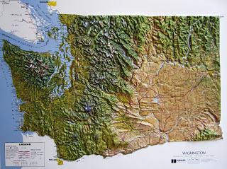 |
| Order a raised relief map of Washington State. It's an enhancement to any home. Clouds not included. |
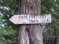
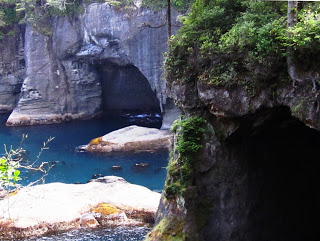
Because our Pacific Northwest clouds are born over the Pacific Ocean, however, I first needed to observe the clouds moving over the water. First stop: Cape Flattery, WA, the northwestern-most spot in the Lower 48 and just 2 hours west of Port Angeles. Cape Flattery is within the Olympic Mountains physiographic province, which takes in the entire Olympic Peninsula--an area known more for its spectacular mountains, lush rain forests, beaches, and lakes than for its continentally extreme cloud-viewing platforms.
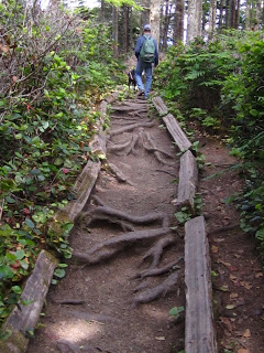
Reaching the very tip of Cape Flattery is easy. It's just a 30-minute walk along a beautiful wilderness trail and cedar boardwalk that winds its way through the forest and wetlands on the Makah Indian Reservation.
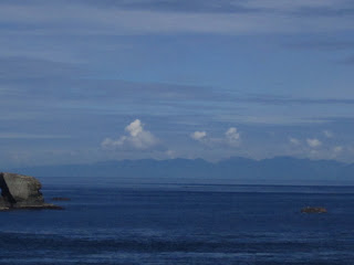
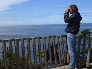
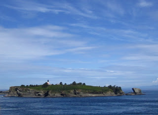
At the end of the trail are four viewing decks. The one my husband and I spent two hours faced Tatoosh Island to the northwest, but covered a good southwest to northeast swath of the Strait of Juan de Fuca and the sky above it.
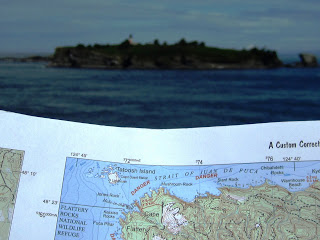 |
| Here is our topo sheet showing Cape Flattery and Tatoosh Island. I am standing on the cape, photographing the island. Too bad I didn't orient the map correctly. But you get the idea. |
We savored the scenery--the sea cliffs, blue-green water, bald eagles, Vancouver Island (above), sea lions, pigeon guillemots by the hundreds in cliff nests and in cooing pairs on the water. I took photographs of clouds. My husband took photographs of me looking at the clouds. I looked at everything through my binoculars and polarizing sunglasses. I watched the clouds. I looked West. And then I started traveling.
I followed the surface of the ocean with my eyes west to the horizon, then followed the bases of the clouds from the horizon back toward me until I was looking overhead. And then I followed the clouds back to the horizon and the ocean surface back. These look to me like cirrostratus clouds--high, icy clouds--that were forming somewhere out there on the Pacific. And this is why I have been so late in posting this blog. I had started my Tour at a place where the landforms have no influence on the clouds, a place where I had to tackle the Pacific Ocean. I nearly drowned.
Luckily, I have figured out all you need to know about the Pacific Ocean to enjoy this blog. Here goes.
The Pacific Ocean is 63.8 million square miles and is larger than all the earth's land areas combined. It holds 159 million cubic miles of salt water. I will not ask you to imagine how many swimming pools this is. Even a really huge swimming pool is incomprehensible. Human beings have problems imagining the very large and very small. Let it suffice to say that the Pacific Ocean exerts an enormous, profound, powerful influence on the planet.
The surface temperature of the North Pacific Ocean in our neck of the woods (Alaska to southern California) typically ranges from 45-50 degrees F year round. While not exactly warm, these waters are considerably warmer than the masses of air that flows over it from Asia and the frozen polar regions of the globe. These air masses are known as the continental Arctic (cA) and continental Polar (cP).
These air masses are cold and dry where they originates, but they doesn't stay at home. They move eastward and southward along the polar jet stream--one of several undulating currents of air that circle the globe. These jet streams are thousands of miles long, hundred miles wide, and several miles deep. In other words, unimaginably huge. They travel 100-200 m.p.h. at 5-8 miles above the earth. They are invisible. (hey are not to be confused with contrails produced by jet planes.)
So, imagine an unimaginable mass of cold dry air speeding its way eastward over the unimaginably huge Pacific Ocean. Over thousands of miles, this mass of air picks up warmth and moisture from the Pacific Ocean. It becomes a Maritime Polar Air Mass (mP) and may cover many thousands of square miles. Also unimaginably huge and aiming for the Pacific Northwest.
As it happened on July 10, as this mass of warm, moist air moved inland, it encountered a mass of cooler, denser air. The front edge of the invading air, in this case, is known as a warm front. As this front advanced, it began rising up over the cooler, denser air. Thanks to Eric Sloane's illustration below, you can see how this works. (The clouds first appear at the leading edge of the front above the man's head).
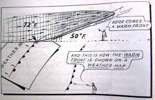 |
| from Eric Sloane's Weather Book (Dover Publications, 2005) |
And, thanks to the photographs I took, you can see a predictable progression of clouds showing a gradual "lowering" of the sky--from high wispy cirrus down to thick altocumulus. These four photos move from east to west and over a period of about four hours.
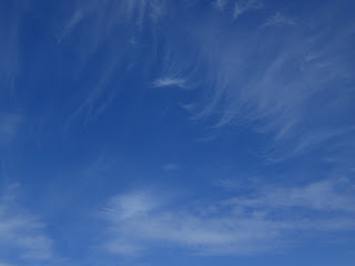 |
Cirrus clouds greeted us at Cape Flattery at 10:30 a.m. This photo was taken toward the east a bit, indicating the warm front was already inland a bit by the time we arrived. |
|
The cirrus clouds begin to thicken to cirrostratus. This photo was taken to the north.
|
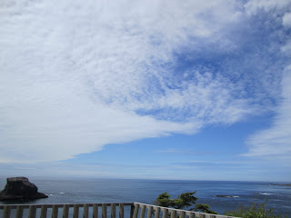 |
| To the west, over the Pacific, thickening, lowering altostratus clouds |
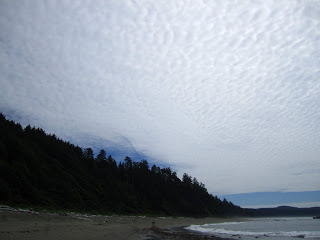 |
Four hours later, a blanket of altocumulus clouds covers most of the sky. This photograph was taken just south of Cape Flattery at Shi Shi beach; camera aiming to the southwest.
|
As it turns out, this particular front brought more clouds, but not nimbostratus (the rain clouds) inland to Olympia. There was another mass of wet air right behind this one, and another, and another, and another.
Can't you just taste that salty Pacific Ocean water in the rain?