
 |
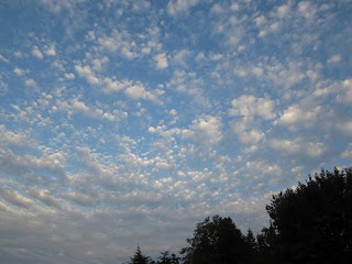
| The show stopper: Altocumulus perlucidus |
This is what you might have missed over Olympia last night around sunset had you been looking at any number of screens available to you. I am not talking about screen doors, but the other kind, the kind you plug in and forget to look up from because you sense some strange urgency there.
text-align: left;"> Without a trace of urgency, but on a steady wind from the south, these altocumulus perlucidus moved in silently late yesterday afternoon. I was in my hammock when the first several appeared in the blue sky and over the dark roof line. I wasn't sure what they were--they were too large for cirrocumulus and too small for cumulus humilis or fractus. I can't recall having seen them before. And so I went out for a walk under the celestial dome.
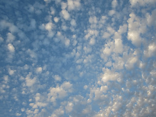 |
| A sky full of popcorn or spilled cotton balls? |
As you can see from the photograph above, that shading is different in nearly every cloudlet as each cloudlet is being shaded by the cloudlet, or cloudlets, to its west.
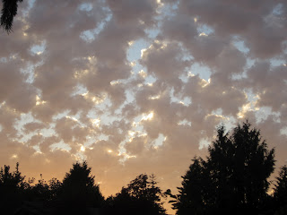 Every time I started to head for home--thinking the show was over and the cloud were going to turn a flat, drab gray--they lingering light of the setting sun kept on with its finales with me offering a standing-walking ovation.
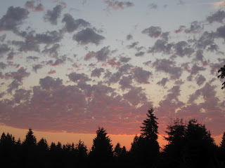
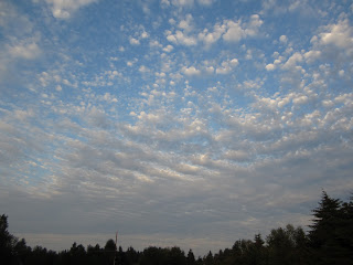
Looking to the east (above), you can see the individual cloudlets starting to thicken toward the horizon. I wasn't sure if this was because of my perspective, or there was something else going on. So I turned back toward the west and watched for another hour while the setting sun turn the white clouds into shades of lavender, gray, pink, and orange that would challenge the best of painters to reproduce.
This morning the solid gray skies were evidence that those cloudlets had ganged up overnight into a low sun-obnubilating mass. I check Art Rangno's Guide to the Sky poster and here is what he says about altocumulus perlucidus: "...usually indicates that large areas (thousands of square miles) are undergoing gradual ascent brought about by an advancing trough and area of low pressure." Which could mean rain--but it doesn't--at least not today. Checking in with the National Weather Service charts and forecasts (which don't address clouds specifically), it looks to me like these clouds were "embedded moisture" in the "southerly flow," clouds that made the skies "bumpy."
The gray of this morning is stratus clouds--fog--pushing in from the coast. It is supposed to retreat from whence it came later today, giving us our sunny skies. And maybe a chance for another spectacular sunset.