Standing on the rim of the spectacular Dry Falls canyon 400 feet high and 3 miles wide and looking down into still pools of water, it is hard to imagine what was once the world’s largest waterfall flowing over this rim. “Flowing” hardly describes what the water was doing. It was churning, chewing, rushing, gushing, flooding, scouring, plucking, wrenching, and muscling its way through the layers of volcanic basalt of the Columbia Plateau on its way toward the Pacific Ocean. Where did all this water come from? During the end of the Pleistocene ice age, between 18,000 and 15,000 year ago, when the Cordilleran Ice Sheet covered much of North America, a glacier a half a mile thick advanced southward from Canada into the Idaho panhandle where it blocked the flow of the Clark Fork River. This caused the river to back up into the mountain valleys and form a vast lake known as Glacial Lake Missoula, in what is today western Montana. At its peak, this lake was 2,100-feet deep and held over 530 cubic miles of water (as much as Lakes Eerie and Ontario combined). When the ice dam broke up, all that water was released across the landscape and emptied Glacial Lake Missoula in a matter of a few days. The water flooded across the Columbia Plateau at speeds of up to 65 mph, carrying with it huge blocks of ice, massive boulders, columns of basalt, trees, animals, anything in it is path. The water eventually followed the course of the Columbia River, south and then west to the Pacific Ocean.
These epic ice-damming-and-flooding events happened not once, but as many as seventytimes during this period. Known as the Missoula Floods or the Spokane Floods, these flooding events created a landscape as magnificent as the more eloquently named Grand Canyon, thought that natural treasure is the work of the relatively slow and patient work of the Colorado River, not the multiple cataclysms of a single lake.
The floods created a regional landscape known, unfortunately, as “channeled scablands.” Yes, the floods did carve channels in the basalt. Yes, the eroded-but-remaining ragged basalt “islands” between the channels could appear to resemble raised scabs on skin, but really?
The name “channeled scablands” was coined in the 1920s by the now-famous geologist J. Harlen Bretz, who proved to the very-resistant scientific community that ancient cataclysmic floods –and not eons of slow erosion--created this unique landscape. Though “scabland” was already in use by the locals, I wonder if anyone (Harlen’s wife, Fanny, perhaps) suggested that perhaps “Glacial Glorylands” or “Channeled Heartland” might have been a better choice.
Glacial Lake Missoula was not the only glacial lake within the channeled scablands stretching across Montana, Idaho, Washington, and Oregon. In Washington, Glacial Lake Columbia formed 50 miles north of present-day Coulee City, when a Pleistocene-era glacier blocked a section of the west-flowing Columbia River that drained through this area. The Columbia was diverted southward where it augmented the work of Glacial Lake Missoula carving a series of canyons known today as “Grand Coulee.”

Map from National Geographic’s “Channeled Scablands.” Read excellent story here.
Coulee is a geologic term, describing canyons or ravines formed by water erosion or floods. Coulee is derived from the French couler, meaning “to flow.” The only explanation I have read for why this very American piece of real estate has a fancy French name comes from my trusty Oxford English Dictionary, which suggests the word may have entered the lexicon through French fur trappers in the Oregon region, trappers who were presumably used this word while tramping through steep terrain en route to blessedly flat beaver ponds and meadows.
The Grand Coulee features two main canyons. The northern canyon holds Banks Lake and is filled with water diverted from the Columbia by the Grand Coulee Dam. The southern canyon holds no lake but several small lakes. These groundwater-filled lakes are not for swimming or fishing but for stretching our imaginations. These ponds were once the deep plunge pools of the diverted and flooding Columbia River as it reshaped itself into a 3.5-mile-wide waterfall that dropped 400 feet from its lip. Though these falls would have once dwarfed Niagara Falls, the retreat of the Columbia River to its old channel left us with the more stunning and less touristy geologic wonder now known as Dry Falls.
Had the northern half of the Grand Coulee not been dammed in 1942, Banks Lake would likely look very similar to Dry Falls: a steep-walled coulee of exposed basalt and worn bedrock holding small lakes. Imagine the southern end of the Dry Falls coulee being dammed and then being filled with water diverted from the Columbia. When you swim in Banks Lake, this is what you are swimming in.
The construction of the Grand Coulee Dam began in 1933 during the administration of Franklin Delano Roosevelt to get Americans back to work after The Depression (it employed 12,000 during several years of construction). This U.S. Bureau of Reclamation project was initially conceived to create a storage and delivery system of water for farmland irrigation, but now the dam also generates hydroelectric power (it’s the largest producer in the U.S.) and has created popular recreational lakes. Behind the dam is Franklin D. Roosevelt Lake Recreation Area and below are Banks Lake, Lake Lenore, Soap Lake, and several smaller ice-age lakes that offer fishing, swimming, boating.
These lakes are partly natural. The wide channels were carved by ice-age flooding but the lakes are not fed by groundwater, rain or snow melt, or an inflow stream. They are fed by an artificial canal that flows upstream of the Grand Coulee Dam. Though the Columbia River itself no longer not flow through Banks Lake, it’s water—via the feeder canal—does.

This this aerial photo above shows the Grand Coulee Dam, the feeder canal in the center, and the 27-mile-long Banks Lake in the entire upper half of the photo. Banks Lake is actually a reservoir. Twelve of the world’s largest pumps draw water from Roosevelt Lake and pump it into Banks Lake. From there the water is delivered via siphons, pumps and thousands of miles of waterways (canals) to irrigate 600,000 acres of farmland south of the lake. If you squint at your Washington road atlas, you’ll spot the Main Canal as well as the “Bacon Siphon” south of Banks Lake. (Yes, The Bacon Siphon would make a good name of a roadside diner. Down-the-rabbit-hole history on naming of Bacon here.

Water from the Columbia River is diverted from the Grand Coulee Dam and pumped up into Banks Lake via this engineered canal. (Photo by M.M. Ruth)
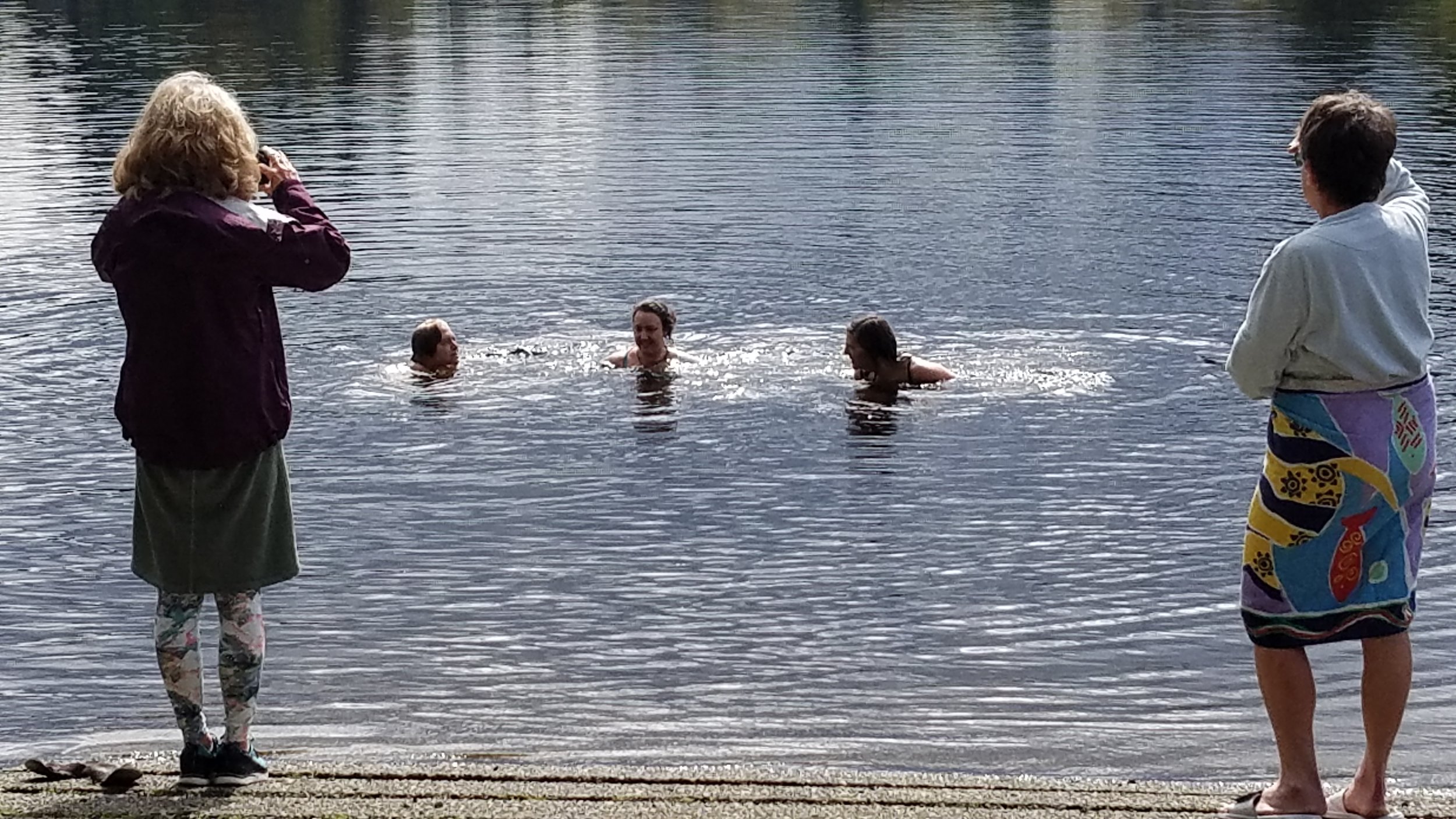
When I moved to Washington in 2006, the Missoula Floods popped up in conversation every once in a while (the Bacon Siphon never did), but I retained only that these floods were humongous and originated in Montana. Even when, a few years later, I made my first trip to eastern Washington with friends for a late-summer “swim tour” of Banks Lake, the geologic history of coulee country and the channeled scablands just washed over me. I believe I was so preoccupied with the Big Swim, with keeping pace with my serious long-distance swimmer friends, and with not getting hypothermic and drowning that I did not fully embrace the terror of water, ice, boulders, and basalt, that was the legacy of the now lovely and becalmed Banks Lake.
What I remember of my Banks Lake swim a decade ago seems like a dream. It was September and post peak tourist season. It was 90-degrees hot, sunny, dry, and the landscape was nothing like western Washington. We parked near a campground at Steamboat Rock State Park and then walked down a deserted trail to a white sandy beach. The three of us got in the water and set our sights across the narrow passage in Devil’s Punchbowl to the east side of the lake. When we noticed a lull in motorboat traffic, we swam like mad across the passage and then entered a cove. The cove was a narrow labyrinth of half-submerged boulders. The labyrinth was too narrow for a kayak and, in places, just wide enough for a single swimmer.
During our swim, we pulled ourselves out of the water and onto the sun-warmed rocks to take the chill off. Once our goosebumps were gone and our skin was dry, we slipped back into the water and the rest of the world slipped away. This was unlike any place I had ever been or dreamed of. We swam for hours here and further south at Lake Lenore. We were floating the ice-age channel filled with water from the Columbia River. We were swimming in the landscape. This is one of the things I love most about swimming in lakes. I’m in water but I feel nestled in the solid Earth.
I spend a lot of time walking in forests and, short of getting inside a hollow tree or digging myself a hole in the forest floor and lying down in it, I have not yet managed to reach that immersive state that I do in a lake. Though I am working on imagining I am inthe sweet moist atmosphere of the forest, I am still walking among trees and shrubs.
In hindsight, I am glad that I swam unencumbered by the geologic history of this place, by familiarity with the workings of the Grand Coulee Dam, the network of irrigation siphons and canals, the flooded towns and lost homesteads, and impact on the Colville tribe that fished the Columbia River above the dam, the meaning of the word “reclamation.”
I cannot remember the clarity of the water, whether or not there were submerged plants to swim through, or if I could see the bottom of the lake. Alas, I’ve lost any photographs I might have taken on this trip. My memory has been distilled into “it felt really good.” The water. The rocks. The depth. The sun. But mostly the water.
I’ll post on Banks Lake again after I find my way back to the labyrinth this summer. My poorly timed spring visit proved to be too early. My once deliciously liquid lake was still frozen.

Nice to have Banks Lake locked in ice for my tour of my Ice-Age Geology tour of the Grand Coulee. (Photo by M.M. Ruth)
FOR FURTHER READING…
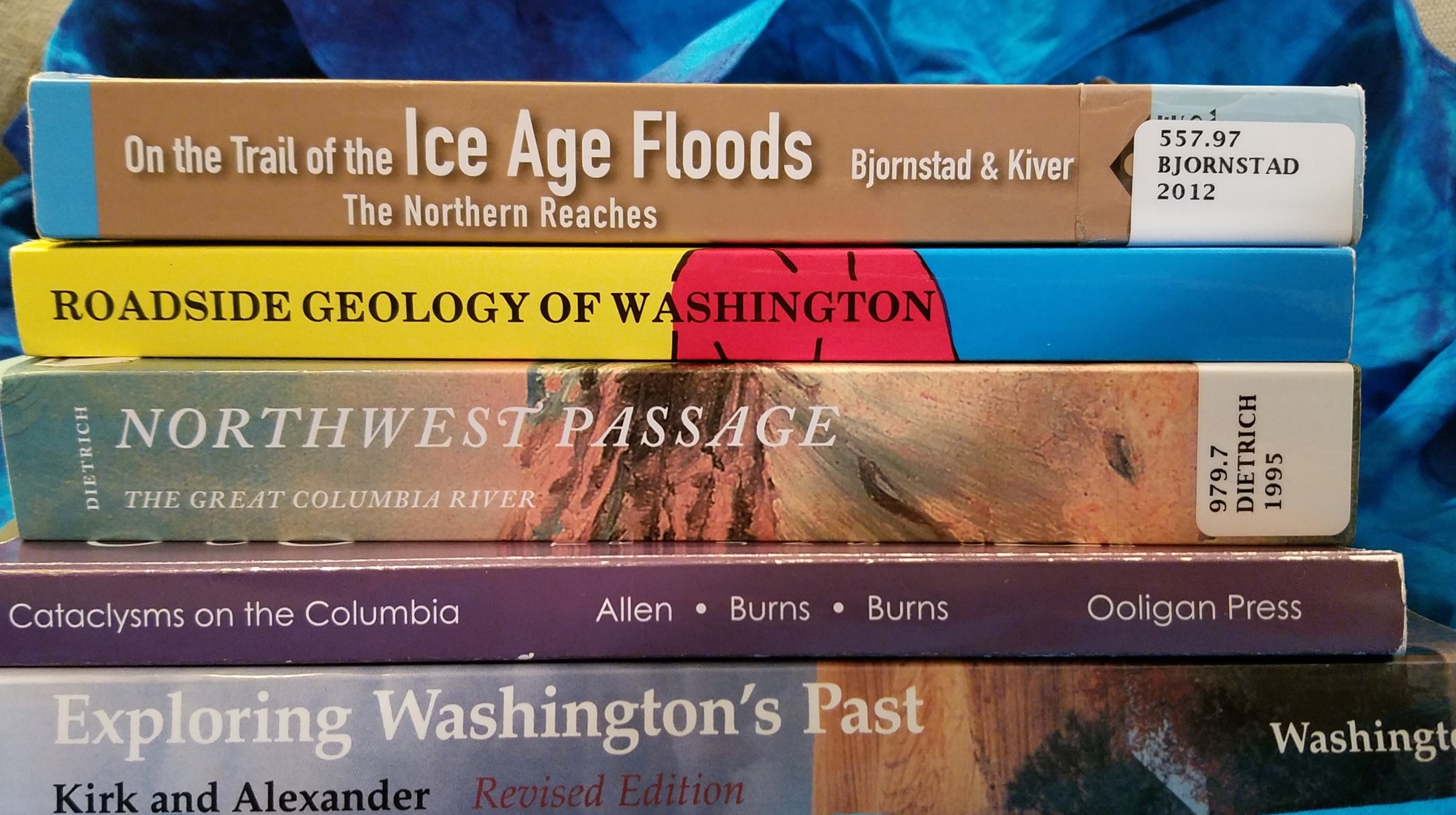
Just some of the readily available books on how our friend, the water molecule, ganged up on the Columbia Plateau. (Photo by M.M. Ruth)
Can’t Get Enough?
Check out the Washington State Department of Natural Resources’s beautiful Washington’s Ice-Age Floods story map.
And here are some maps and resources from the Ice Age Flood Institute on the Ice Age Floods National Geologic Trail.