• Home
  • Author
  • Clouds
  • Blog
  • Events
  • Rare Bird
  • Marbled Murrelets
  • Lakes
Menu

Maria Mudd Ruth

Street Address
City, State, Zip
Phone Number
author and naturalist
Homepage-Banner.jpg

Maria Mudd Ruth

  • Home
  • Author
  • Clouds
  • Blog
  • Events
  • Rare Bird
    • Rare Bird
    • Marbled Murrelets
  • Lakes

“I Need to Show You This Lake...

September 2, 2019 Maria Mudd Ruth
Shhhhhh.                                                                                                                                           Photo by M. M. Ruth

Shhhhhh. Photo by M. M. Ruth

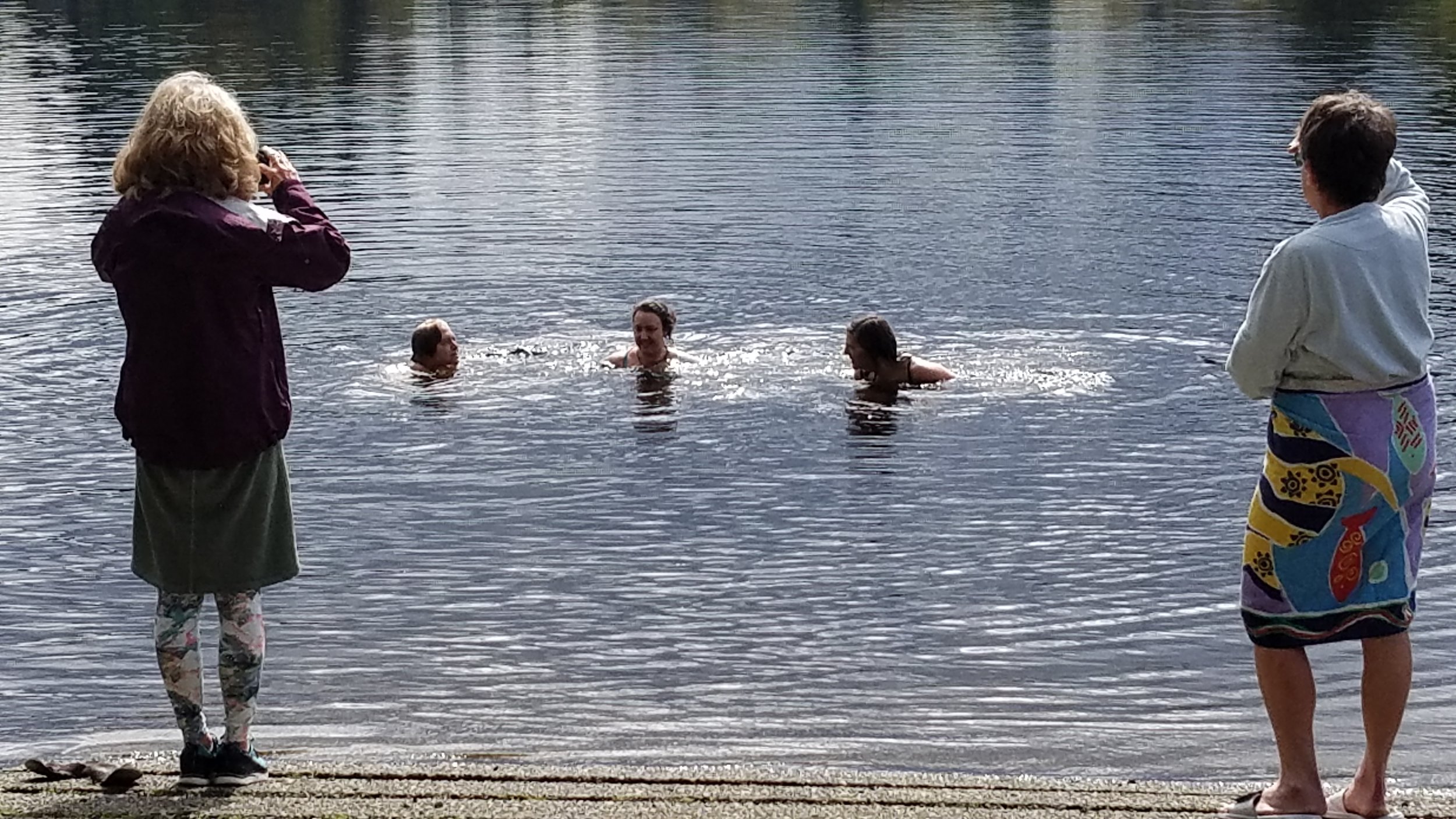
…only I can’t tell you where it is and you can’t tell anyone once we show it to you.”

Over the summer a few of my fellow lake-swimming enthusiasts have been kind enough to take me to their secret lakes as long as I promised not to provide the name or directions to others. I’ve found these secrets easy to keep because Washington state boasts thousands of swimming lakes. I feel lucky to live in a landscape so pervious, pock marked, glacier scoured, and potholed that the secret holders are not depriving anyone of the experience of lake swimming.

Most of our swimmable lakes are accessible by public boat ramp, dock, beach, or trail. The secret lakes require way-finding skill and sometimes a bit of bushwhacking. Trail markers and cairns are entirely absent.

None of the secret lakes I’ve been to have official names and don’t always appear on maps. They become known because someone discovers them and then they tell a friend who tells two friends and so on. And, while I might tell you about these lakes, I cannot for the life of me retrace my steps to return to them or describe the roads and routes and landmarks that would get you anywhere but lost.
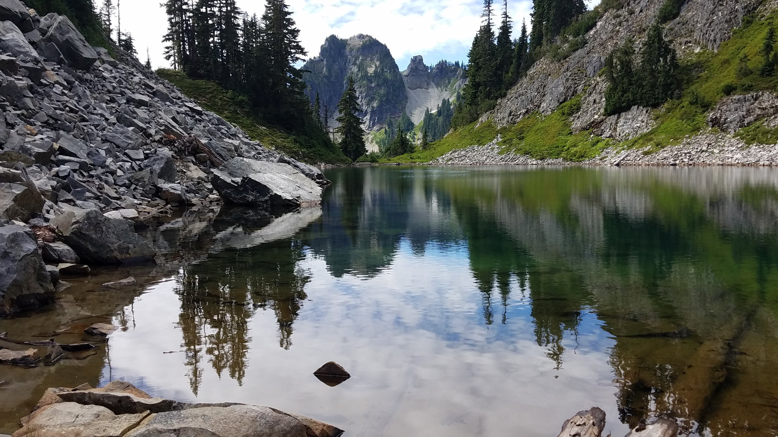
Photo by M.M. Ruth

Photo by M.M. Ruth

So it was this past when when two friends guided me on a hike-scramble to this beauty. It was the clearest water I have ever swum in—so clear that it is easy to forget it is water. So clear that, as one friend said, “it’s hard to remember not to breathe it.”

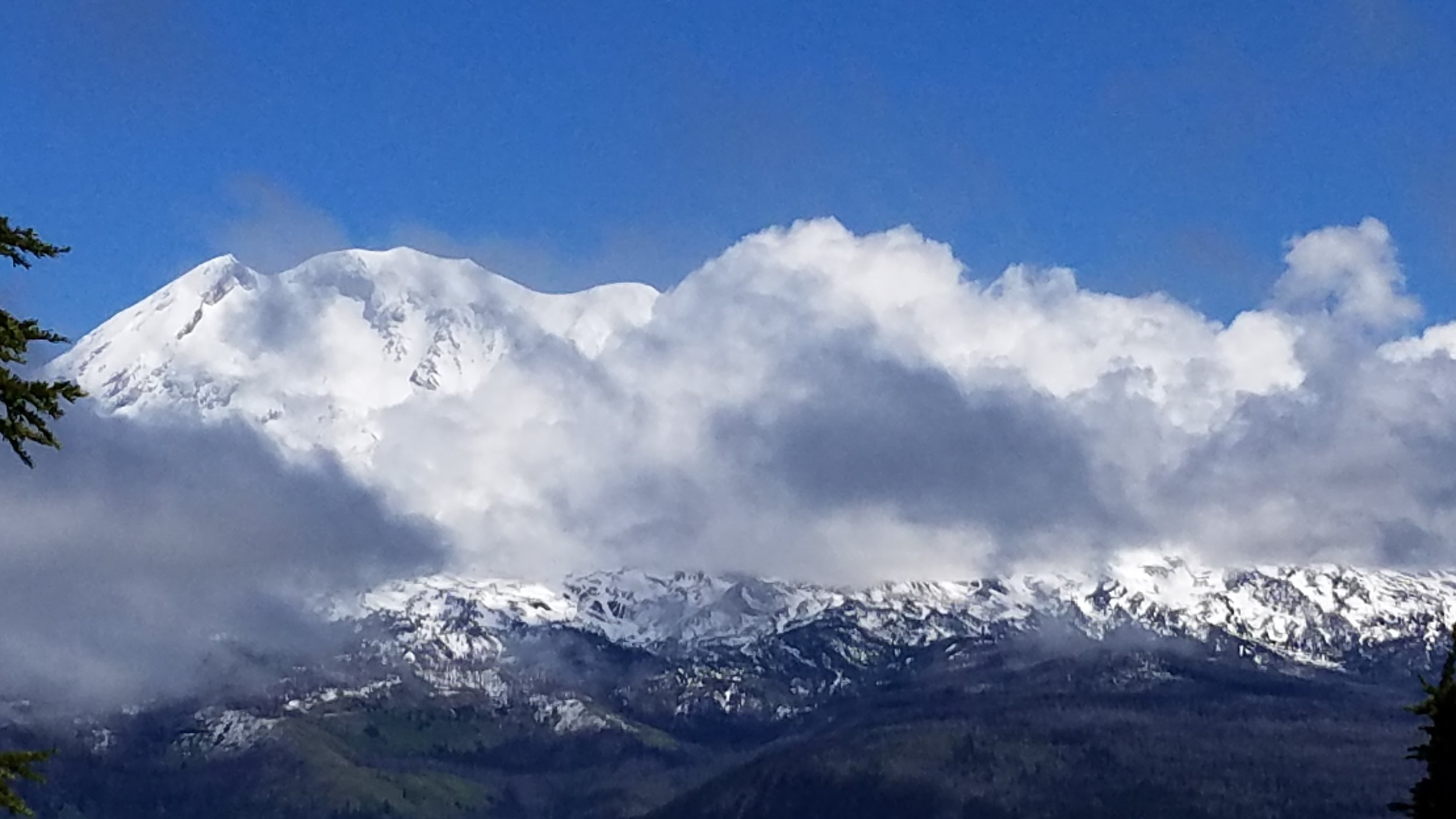
It was what I might once have called “freezing” but now, after months of lake swimming, I’ll call it perfectly delightful cold. We swam, floated and swam some more. When the clouds parted and the sun shone down on the lake, we warmed up on the rocks on the far shore. The lake was silent save for the occasional squeak of a pika and the clattering wings of the grasshoppers echoing against the rocks and cliff. There was no human presence at all—just wilderness all around.

While the sun warmed our skin it also warmed the thin skin of the lake. When we slipped back into the water, the top few inches of the lake had noticeably warmed. To preserve that layer of warm water, we swam slowly without kicking and churning up the cold water beneath. I stretched out on my back and floated, spinning slowly around to memorize the contours of the shore, hill, and peaks and to take in the last bit of summer’s warmth.

I left the water and walked down the sandy shoreline toward my towel, lunch, and thermos of hot tea. I walked slowly, scanning the edge of water for newts. Something caught my eye. There on the beach, scrawled in the sand in all capital letters:

ONLY

WITH

SOUL

In Lake Swimming, Natural History, Open-water Swimming, Washington Lakes, Wild Swimming, Wild Swimming Washington Tags Lakes of Washington, Lake Swimming in Washington, Wild Swimming

Washington Lakes--Lost and Found

June 29, 2019 Maria Mudd Ruth
Take your hip waders but leave your wet suit and swimming goggles in the car.

Take your hip waders but leave your wet suit and swimming goggles in the car.

This is Disappearing Lake in the Gifford Pinchot National Forest the Mount Adams Ranger District in Klickitat County. It’s part of the gorgeous South Prairie and functions as a wetland and prairie in the summer, a basin for holding rain, snow, and ice in the fall and winter, and a lake for a very short period in the spring.

You’ve probably heard of Mt. Hood (second largest volcano in Lower 48), the town of Hood River, Oregon (famous as a wind-surfing, soft-fruit, and craft-beer mecca) and it’s sister town, White Salmon, Washington (white-water rafting, mellow non-Hood-River vibe). You may also be familiar with Gifford Pinchot National Forest—the 1.3 million acres of forested land stretching north from the Columbia River gorge.

As a day hiker who defaults to the Olympic Peninsula and Mt. Rainier for recreating, I have only occasionally visited this beautiful part of Washington State. A few times to hike in the Gifford Pinchot National Forest and once to survey for the egg masses of the endangered Oregon Spotted Frog. Never once did I hear or read about Disappearing Lake or the lake from which the town of Trout Lake gets its name.

Not until I began my research on Washington Lakes and lake swimming and watched a 2014 episode of Oregon Field Guide (it’s just 6 minutes long, worth a viewing) did I learn about Disappearing Lake. It doesn’t show up on most maps or Forest-Service road signs. It’s just called South Prairie. Which makes sense. It’s part of an extensive prairie south of Mt. Adams and is a prairie from mid-summer to late-fall and then, when the rains come the prairie begins to fill with water. The water that fills a lava tube freezes and acts like a plug in a bathtub. The prairie fills up with rainwater and snow and, in late spring, emerges as a beautiful lake you can canoe and kayak on if you time it right. Like most of my wilderness adventures (see my blog on Banks Lake), I’m always a bit off on my timing of natural spectacles. We arrived in mid-June having just missed the canoe-able—and I had hoped chilly-but-swimmable—period of Disappearing Lake. Alas, I’d pack my wetsuit again next spring and be ready to head to the lake on a moment’s notice to try again.

Not wanting to feel foolish about driving for 4 hours with a canoe strapped to the top of our car and not getting it wet, we headed for Goose Lake. But it was raining heavily that Friday afternoon and there was a fishing derby on the lake the next day. So my husband and I up Sleeping Beauty instead for bit of aerobic exercise and a spectacular view of Mt. Adams dancing with the cumulus clouds. What could top this as a consolation prize?

Mt. Adams and the clouds from atop a rock formation known as “Sleeping Beauty.”

Mt. Adams and the clouds from atop a rock formation known as “Sleeping Beauty.”

On the way back from the hike, we drove through the town of Trout Lake, wondering exactly the eponymous lake was and why there were no signs (not even the subtle Forest Service brown ones) advertising its presence. My husband had a hunch we might have luck following Lake Rd. a road marked as a Dead End. A few minutes later, we parked our car at a classic wooden kiosk and were happy to discover we needed a Discovery Pass. We had arrived at the Trout Lake Natural Area Preserve (NAP) managed by the Washington Department of Natural Resources (DNR). The lake was part lake, part creek, part wetland and a hot spot for the endangered Oregon Spotted Frog.

Screen Shot 2019-06-13 at 5.39.07 PM.png
Screen+Shot+2019-06-13+at+5.40.16+PM.jpg

On our left was an interpretive trail that hugged the southwest side of the creek and wetland. Here we learned that an avalanche of volcanic debris and mud, known as a lahar, flowed down from Mt. Adams about 6,000 years ago. The lahar traveled some 35 miles, following the river channels and leaving deposits as thick as 65 feet. The lahar raised the floor of the White Salmon River, thus blocking one of its tributaries—today’s Trout Lake Creek. The newly formed lake was much more extensive than it is today; sedimentation, especially over the last 50 years, has been filling in the open lake, increased the wetlands.

Screen Shot 2019-06-29 at 8.13.34 AM.png

After our short trail walk, we returned to our car and noticed a pair of flip-flops on the muddy edge of the water. That was the only sign I needed that it was time to grab my wetsuit and goggles and launch the canoe.

20190609_110110.jpg

We weren’t sure if we’d be paddling in a creek or a lake or deadend in a meadow of reed canary grass or for how long before we got stuck, but the water called. To our delight and amazement, we paddled for a good 30 minutes up the most gentle, intimate little waterway a Discover Pass could buy. The shore was undeveloped the bank was tangled with all the makings of a Hollywood riparian buffer: reeds, sedges, rushes, grasses, willows, snags, and cottonwood trees further off. Paddling upstream was easy and the water so inviting.

20190609_124242.jpg

We pulled off in an eddy at a very grassy spot and, with Oregon Spotted Frog tadpoles wiggling around my toes, I braced myself for a plunge into the clear cold water flowing off Mt. Adams in the distance.

20190609_122540.jpg

Despite my attempt at looking relaxed (what’s with my right foot?), it was nearly impossible to go gently into that good lake. Or any lake-river that takes your breath away and leaves you uttering ridiculous but ultimately helpful self-motivating phrases.

Getting upstream was harder than I thought. But worth the effort. My first-ever downstream swim was like flying.

In Lake Swimming, Geology of Washington, Lakeside Geology, Natural History, Open-water Swimming, Volcanoes, Washington Lakes, Wild Swimming, Wild Swimming Washington Tags Lake Swimming in Washington, Trout Lake Washington, Disappearing Lake, Gifford Pinchot National Forest, Mt. Adams Washington, Department of Natural Resources, Natural Area Preserve, Outdoor Swimming

Banks Lake

April 16, 2019 Maria Mudd Ruth
The calm after the storm: Dry Falls , just south of Coulee City, WA, marks the southern end of the 27-mile-long Banks Lake.

The calm after the storm: Dry Falls , just south of Coulee City, WA, marks the southern end of the 27-mile-long Banks Lake.

 Standing on the rim of the spectacular Dry Falls canyon 400 feet high and 3 miles wide and looking down into still pools of water, it is hard to imagine what was once the world’s largest waterfall flowing over this rim. “Flowing” hardly describes what the water was doing. It was churning, chewing, rushing, gushing, flooding, scouring, plucking, wrenching, and muscling its way through the layers of volcanic basalt of the Columbia Plateau on its way toward the Pacific Ocean. Where did all this water come from? During the end of the Pleistocene ice age, between 18,000 and 15,000 year ago, when the Cordilleran Ice Sheet covered much of North America, a glacier a half a mile thick advanced southward from Canada into the Idaho panhandle where it blocked the flow of the Clark Fork River. This caused the river to back up into the mountain valleys and form a vast lake known as Glacial Lake Missoula, in what is today western Montana. At its peak, this lake was 2,100-feet deep and held over 530 cubic miles of water (as much as Lakes Eerie and Ontario combined). When the ice dam broke up, all that water was released across the landscape and emptied Glacial Lake Missoula in a matter of a few days. The water flooded across the Columbia Plateau at speeds of up to 65 mph, carrying with it huge blocks of ice, massive boulders, columns of basalt, trees, animals, anything in it is path. The water eventually followed the course of the Columbia River, south and then west to the Pacific Ocean.

These epic ice-damming-and-flooding events happened not once, but as many as seventytimes during this period. Known as the Missoula Floods or the Spokane Floods, these flooding events created a landscape as magnificent as the more eloquently named Grand Canyon, thought that natural treasure is the work of the relatively slow and patient work of the Colorado River, not the multiple cataclysms of a single lake. 

The floods created a regional landscape known, unfortunately, as “channeled scablands.” Yes, the floods did carve channels in the basalt. Yes, the eroded-but-remaining ragged basalt “islands” between the channels could appear to resemble raised scabs on skin, but really? 

The name “channeled scablands” was coined in the 1920s by the now-famous geologist J. Harlen Bretz, who proved to the very-resistant scientific community that ancient cataclysmic floods –and not eons of slow erosion--created this unique landscape. Though “scabland” was already in use by the locals, I wonder if anyone (Harlen’s wife, Fanny, perhaps) suggested that perhaps “Glacial Glorylands” or “Channeled Heartland” might have been a better choice.

Glacial Lake Missoula was not the only glacial lake within the channeled scablands stretching across Montana, Idaho, Washington, and Oregon. In Washington, Glacial Lake Columbia formed 50 miles north of present-day Coulee City, when a Pleistocene-era glacier blocked a section of the west-flowing Columbia River that drained through this area. The Columbia was diverted southward where it augmented the work of Glacial Lake Missoula carving a series of canyons known today as “Grand Coulee.” 

Map from National Geographic’s “Channeled Scablands.” Read excellent story here.

Map from National Geographic’s “Channeled Scablands.” Read excellent story here.

Coulee is a geologic term, describing canyons or ravines formed by water erosion or floods. Coulee is derived from the French couler, meaning “to flow.” The only explanation I have read for why this very American piece of real estate has a fancy French name comes from my trusty Oxford English Dictionary, which suggests the word may have entered the lexicon through French fur trappers in the Oregon region, trappers who were presumably used this word while tramping through steep terrain en route to blessedly flat beaver ponds and meadows. 

The Grand Coulee features two main canyons. The northern canyon holds Banks Lake and is filled with water diverted from the Columbia by the Grand Coulee Dam. The southern canyon holds no lake but several small lakes. These groundwater-filled lakes are not for swimming or fishing but for stretching our imaginations. These ponds were once the deep plunge pools of the diverted and flooding Columbia River as it reshaped itself into a 3.5-mile-wide waterfall that dropped 400 feet from its lip. Though these falls would have once dwarfed Niagara Falls, the retreat of the Columbia River to its old channel left us with the more stunning and less touristy geologic wonder now known as Dry Falls.  

Had the northern half of the Grand Coulee not been dammed in 1942, Banks Lake would likely look very similar to Dry Falls: a steep-walled coulee of exposed basalt and worn bedrock holding small lakes. Imagine the southern end of the Dry Falls coulee being dammed and then being filled with water diverted from the Columbia. When you swim in Banks Lake, this is what you are swimming in.

The construction of the Grand Coulee Dam began in 1933 during the administration of Franklin Delano Roosevelt to get Americans back to work after The Depression (it employed 12,000 during several years of construction). This U.S. Bureau of Reclamation project was initially conceived to create a storage and delivery system of water for farmland irrigation, but now the dam also generates hydroelectric power (it’s the largest producer in the U.S.) and has created popular recreational lakes. Behind the dam is Franklin D. Roosevelt Lake Recreation Area and below are Banks Lake, Lake Lenore, Soap Lake, and several smaller ice-age lakes that offer fishing, swimming, boating. 

These lakes are partly natural. The wide channels were carved by ice-age flooding but the lakes are not fed by groundwater, rain or snow melt, or an inflow stream. They are fed by an artificial canal that flows upstream of the Grand Coulee Dam. Though the Columbia River itself no longer not flow through Banks Lake, it’s water—via the feeder canal—does. 

Screen Shot 2019-04-16 at 9.17.55 AM.png

This this aerial photo above shows the Grand Coulee Dam, the feeder canal in the center, and the 27-mile-long Banks Lake in the entire upper half of the photo. Banks Lake is actually a reservoir. Twelve of the world’s largest pumps draw water from Roosevelt Lake and pump it into Banks Lake. From there the water is delivered via siphons, pumps and thousands of miles of waterways (canals) to irrigate 600,000 acres of farmland south of the lake. If you squint at your Washington road atlas, you’ll spot the Main Canal as well as the “Bacon Siphon” south of Banks Lake. (Yes, The Bacon Siphon would make a good name of a roadside diner. Down-the-rabbit-hole history on naming of Bacon here.

Water from the Columbia River is diverted from the Grand Coulee Dam and pumped up into Banks Lake via this engineered canal. (Photo by M.M. Ruth)

Water from the Columbia River is diverted from the Grand Coulee Dam and pumped up into Banks Lake via this engineered canal. (Photo by M.M. Ruth)

When I moved to Washington in 2006, the Missoula Floods popped up in conversation every once in a while (the Bacon Siphon never did), but I retained only that these floods were humongous and originated in Montana. Even when, a few years later, I made my first trip to eastern Washington with friends for a late-summer “swim tour” of Banks Lake, the geologic history of coulee country and the channeled scablands just washed over me. I believe I was so preoccupied with the Big Swim, with keeping pace with my serious long-distance swimmer friends, and with not getting hypothermic and drowning that I did not fully embrace the terror of water, ice, boulders, and basalt, that was the legacy of the now lovely and becalmed Banks Lake.

What I remember of my Banks Lake swim a decade ago seems like a dream. It was September and post peak tourist season. It was 90-degrees hot, sunny, dry, and the landscape was nothing like western Washington. We parked near a campground at Steamboat Rock State Park and then walked down a deserted trail to a white sandy beach. The three of us got in the water and set our sights across the narrow passage in Devil’s Punchbowl to the east side of the lake. When we noticed a lull in motorboat traffic, we swam like mad across the passage and then entered a cove. The cove was a narrow labyrinth of half-submerged boulders. The labyrinth was too narrow for a kayak and, in places, just wide enough for a single swimmer. 

During our swim, we pulled ourselves out of the water and onto the sun-warmed rocks to take the chill off. Once our goosebumps were gone and our skin was dry, we slipped back into the water and the rest of the world slipped away. This was unlike any place I had ever been or dreamed of. We swam for hours here and further south at Lake Lenore. We were floating the ice-age channel filled with water from the Columbia River. We were swimming in the landscape. This is one of the things I love most about swimming in lakes. I’m in water but I feel nestled in the solid Earth.

I spend a lot of time walking in forests and, short of getting inside a hollow tree or digging myself a hole in the forest floor and lying down in it, I have not yet managed to reach that immersive state that I do in a lake. Though I am working on imagining I am inthe sweet moist atmosphere of the forest, I am still walking among trees and shrubs. 

In hindsight, I am glad that I swam unencumbered by the geologic history of this place, by familiarity with the workings of the Grand Coulee Dam, the network of irrigation siphons and canals, the flooded towns and lost homesteads, and impact on the Colville tribe that fished the Columbia River above the dam, the meaning of the word “reclamation.”

I cannot remember the clarity of the water, whether or not there were submerged plants to swim through, or if I could see the bottom of the lake. Alas, I’ve lost any photographs I might have taken on this trip. My memory has been distilled into “it felt really good.” The water. The rocks. The depth. The sun. But mostly the water.

I’ll post on Banks Lake again after I find my way back to the labyrinth this summer. My poorly timed spring visit proved to be too early. My once deliciously liquid lake was still frozen.

Nice to have Banks Lake locked in ice for my tour of my Ice-Age Geology tour of the Grand Coulee.  (Photo by M.M. Ruth)

Nice to have Banks Lake locked in ice for my tour of my Ice-Age Geology tour of the Grand Coulee. (Photo by M.M. Ruth)

FOR FURTHER READING…

Just some of the readily available books on how our friend, the water molecule, ganged up on the Columbia Plateau. (Photo by M.M. Ruth)

Just some of the readily available books on how our friend, the water molecule, ganged up on the Columbia Plateau. (Photo by M.M. Ruth)

Can’t Get Enough?

Check out the Washington State Department of Natural Resources’s beautiful Washington’s Ice-Age Floods story map.

And here are some maps and resources from the Ice Age Flood Institute on the Ice Age Floods National Geologic Trail.


In Geology of Washington, Lake Swimming, Lakeside Geology, Open-water Swimming, Washington Lakes, Wild Swimming Washington Tags Banks Lake, Dry Falls Sun Lakes State Park, Grand Coulee, Grand Coulee Dam, Columbia River, Lake Lenore, Ice-Age Floods, Missoula Floods, Glacial Lake Missoula, Glacial Lake Columbia, Lake Swimming in Washington, Lakes of Washington

Munn Lake Wild Swim #2

April 14, 2019 Maria Mudd Ruth
Contours of Munn Lake from the marvelous 2-volume inventory, Lakes of Western Washington, by Earnest Woodcut. Washington Dept. of Ecology, 1973. (Both Susan and Trails End Lake are not publicly accessible)

Contours of Munn Lake from the marvelous 2-volume inventory, Lakes of Western Washington, by Earnest Woodcut. Washington Dept. of Ecology, 1973. (Both Susan and Trails End Lake are not publicly accessible)

After a bit of wavering and wobbling and last-minute rescheduling, the first group swim of the season went off…swimmingly! The previous day, I had checked the temperature of the water at Munn Lake (just 4 miles south of Olympia) and also the slightly shallower Deep Lake (further south in Millersylvania State Park). Both lakes were between 56 and 58 degrees F and so we opted for the closer, small, and more sheltered Munn Lake.

Like many of the lakes in Washington state, Munn Lake was formed in the wake of the retreat of the Puget Lobe of the Vashon Glacier that covered South Puget Sound during the last ice age, which occurred 19,000 to 13,000 years before the present time. Munn Lake is within the Deschutes River Basin and is fed by groundwater seeps and precipitation; there are no inflows and outflows from Munn Lake.

This lake was named after Edwin Munn, a dairy farmer who settled in the area in the early 1900s. Thanks to the Washington Department of Fish and Wildlife, which maintains access to the lake via a paved entrance road, parking lot, and concrete slab boat ramp, members of the public can enjoy non-motorized boating, fishing, and swimming in the lake.

On this breezy Friday afternoon in April, four swimmers and a cheering squad of two made drove in a brief rain shower to gather at the top of the boat ramp. We set up chairs, hot water for tea, and pans of brownies and almond cake. There were just two fishermen on the far end of the lake—incentive for us to go gently into this good water.

“Are we really doing this?” I asked because i knew everyone was thinking it.

Yes. Though not without much “Nooooo!” body language, brief posing for a group photo, mild shrieking, and nervous laughter.

Getting psyched: This looks like a summer day on the boat ramp into Munn Lake, but on April 12, the water temperature was 56 degrees F and the air temperature not much higher. While 56 degrees F might be “warm”to some wild swimmers, it seemed “do-ab…

Getting psyched: This looks like a summer day on the boat ramp into Munn Lake, but on April 12, the water temperature was 56 degrees F and the air temperature not much higher. While 56 degrees F might be “warm”to some wild swimmers, it seemed “do-ably brisk” to us. Photo by A. Butler

Our foursome covered what I imagine is the typical range of swimmers: One moved quickly into the water like a mermaid with no fanfare or yelping. One was a wee bit tepid but with a few deep breaths entered the water gracefully, swam several strokes with her head under water and stayed in longer than anyone else. One (me) who really really wanted to get back into the warm car but, once numb from the waist down, stopped resisting, slid in tensely, and then kicked and flapped madly to stay warm. And one who got in up to her neck then retreated to the warmth of dry land to join the cheering squad, vowing to build up her cold-water tolerance. One thing we all had in common was that we were smiling and laughing all the way. And smiling even more broadly when the sun came out.

Getting In: Though we all stood on the boat ramp at the same time, we were out of sync getting in. The two furthest out did a relaxed breast and crawl; the one in the middle (me) flutter kicked; and the one on the foreground wore her flip-flops in, …

Getting In: Though we all stood on the boat ramp at the same time, we were out of sync getting in. The two furthest out did a relaxed breast and crawl; the one in the middle (me) flutter kicked; and the one on the foreground wore her flip-flops in, carried one out while returning to shore soon after her plunge. Photo by A. Butler

I’ve been trying to figure out where the resistance to cold water lies, where the lure of cold water originates, and what is happening physically, mentally, emotionally when we overcome 5 minutes of discomfort to reap the benefits of 15 minutes of immersion in cold water. Does the water actually feel good or is the anticipation of the endorphin exhilaration after the swim enough to block any “pain” we might feel in cold water? Does swimming in a group make the water more tolerable, enjoyable, beneficial?

Or was these feel-good vibes just the effect of being in water, in cold water, or simply out in nature? I think I’ll answer “yes” to all my questions here.

All of this topped by post-plunge cups of hot tea and goodies, conversation, and sunshine.

For more than a decade, I have swum in Munn Lake. Sometimes alone (in summer) and sometimes with other swimmers, floaters, and the fish and the osprey. On the first day of spring this year, I swam in this same lake with a friend. The water was 52 degrees, the air an unseasonable 80. We didn’t really swim. We stayed in the water for a good 15 minutes just smiling and laughing and appreciating the company and the very fact that in the Pacific Northwest, we could just walk into a lake in March and loll around as long as we wanted. That swim was at least twice as much fun as my solo swims and very empowering. I could swim in cold water (and enjoy it) and I lived in a community where other people did too. Similarly, swimming with three other people tripled the fun and having a land-based support group (bundled in down, fleece, and blankets) boosted the fun-o-meter even higher.

Getting out: Once you’re finally in it’s easy to stay in. Photo by A. Butler

Getting out: Once you’re finally in it’s easy to stay in. Photo by A. Butler

Feeling Good: Three levels of head submersion: Full (left), none (middle); only the ends (right). Photo by M.T. Goforth

Feeling Good: Three levels of head submersion: Full (left), none (middle); only the ends (right). Photo by M.T. Goforth

Feeling Better: Oh the joys of warm, dry clothes and a hot cuppa tea! Photo by M.M. Ruth

Feeling Better: Oh the joys of warm, dry clothes and a hot cuppa tea! Photo by M.M. Ruth

MUNN LAKE is a smallish, shallow lake 4 miles south of Olympia. It has easy access via the boat ramp managed by the Washington Department of Fish & Wildlife (Discover Pass required). Because this is a relatively shallow lake (19 feet at its deepest) this lake warms up more quickly than other nearby lakes (Ward, Hewitt, for example). Munn is stocked for catch-and-release fishingh rainbow trout and has a naturally reproducing population of largemouth bass, yellow perch, bluegill, sunfish, and black crappie—though none nibbled at our toes during our swim. As with any lake where fishing and swimming occur, watch your step for hooks and other sharp things. For more info and directions to Munn Lake, visit the WDFW site here. Munn Lake is periodically closed to swimming due to chemical treatment of the invasive aquatic vegetation that blocks the flow of water between Munn and Susan Lake. Warning signs are posted at the boat ramp.

Liquid bliss. Photo by M.M. Ruth

Liquid bliss. Photo by M.M. Ruth

In Lake Swimming, Open-water Swimming, Washington Lakes, Wild Swimming Washington Tags Munn Lake, Lakes in Thurston County, Lakes of Washington, Wild Swimming, Lake Swimming in Washington, Cold-water swimming
Older Posts →

Subscribe

Sign up with your email address to receive my blog in your inbox.

Thank you!
​Connect with Maria elsewhere  Facebook Instagram
Blog RSS

A Sideways Look at Clouds from Mountaineers Books

A Sideways Look at Clouds from Mountaineers Books

Rare BirdORDER TODAY >>

Rare Bird: Pursuing the Mystery of the Marbled Murrelet

“Compelling…  engaging.” —Library Journal

“Rare insights into the trials and joys of scientific discovery.” —Publisher’s weekly

Learn more about Rare Bird...

Enjoy this song by Peter Horne, "Little Bird, Little Boat, Big Ocean... 


The photo for my blog captures the spirit of the accidental naturalist (my husband, actually). The body of water featured here, Willapa Bay, completely drained out at low tide during our camping trip at the Willapa National Wildlife Refuge, leaving …

The photo for my blog captures the spirit of the accidental naturalist (my husband, actually). The body of water featured here, Willapa Bay, completely drained out at low tide during our camping trip at the Willapa National Wildlife Refuge, leaving us a pleasant several hours of experiencing the life of the turning tide.

  • Wild Swimming
  • marbled murrelet
  • clouds
  • A Sideways Look at Clouds
  • Mountaineers Books
  • Rare Bird
  • old-growth forests
  • Open-water Swimming
  • Maria Mudd Ruth
  • Lakes of Washington
You must select a collection to display.

Subscribe

Sign up with your email address to receive my blog in your inbox.

Thank you!
​Connect with Maria elsewhere  Facebook
Blog RSS

©2025 MARIA MUDD RUTH  |  ALL RIGHTS RESERVED